CHI PCSWMM 2024 Professional 2D (v7.7.3920) Advanced Stormwater Modeling
Download the CHI PCSWMM 2024 Professional 2D (v7.7.3920) Advanced Stormwater Modeling from this link…
![]()
Summary
PCSWMM Professional 2D is a comprehensive spatial decision support system for stormwater management and urban drainage modeling. Developed and maintained by Computational Hydraulics International (CHI), this professional software leverages the power of the public-domain EPA SWMM5 engine while adding a robust suite of GIS tools, advanced analytics, and an intuitive graphical interface. The latest version, 7.7.3920, released in March 2025, solidifies PCSWMM’s position as an industry-leading solution for engineers, hydrologists, and urban planners.
Unlike the stand-alone EPA version, PCSWMM transforms the core engine into a dynamic visual environment. It supports integrated 1D/2D modeling, allowing professionals to simulate complex interactions between storm sewers and overland surface flooding with unprecedented accuracy. Whether you are designing green infrastructure or forecasting real-time flood events, PCSWMM provides the tools necessary to handle projects of any scale.
Key Features
PCSWMM distinguishes itself through a deep integration of hydraulic modeling with spatial analysis. The software is designed to streamline workflows, from initial data import to final report generation.
1. Advanced GIS and Data Management
The software acts as a powerful GIS engine specifically tailored for water management engineers. It offers native support for over 50 GIS and CAD layer formats, allowing users to create, edit, and reproject spatial data directly within the modeling environment without needing third-party software. You can leverage background maps from Bing Maps and OpenStreetMaps for instant georeferencing.
2. Integrated 1D-2D Modeling
Version 7.7 builds upon PCSWMM’s strength in dual-drainage modeling. It seamlessly solves both the 1D domain (pipes, channels) and the 2D domain (overland flow) using the SWMM5 dynamic wave equations. This allows for accurate simulation of urban flooding, riverine flooding, and the interaction between surface and sub-surface systems.
3. Low Impact Development (LID) Toolbox
PCSWMM is a critical tool for green infrastructure planning. It includes physically-based modeling for a wide array of LID practices, including bioretention cells, rain gardens, permeable pavement, green roofs, vegetative swales, and infiltration trenches. The Soil Zone, a conceptual layer representing engineered soil, is modeled using specific parameters like porosity, field capacity, and wilting point to accurately simulate infiltration and evapotranspiration.
4. Scripting and Automation
To handle repetitive tasks or complex analyses, it includes a dedicated scripting environment. It supports IronPython natively, allowing users to automate model edits, run batch simulations, and perform advanced statistical analysis. The latest version upgrades JupyterLab to version 4.2.5, providing a modern interface for data science integration and introducing new Python tools (pcpy.Tools, pcpy.TwoD) for 2D mesh generation and flood analysis.
5. Radar-Rainfall and Real-Time Forecasting
For advanced flood warning systems, it supports the acquisition and processing of radar-rainfall data. It includes bias correction methods such as the Rain Gage Moving Average (RGMA) to calibrate radar reflectivity against local ground-truth rain gage networks. This ensures that hydrologic models used for real-time forecasting are driven by the most accurate precipitation data available.
6. Educational and Bibliographic Resources
It integrates a vast knowledge base directly into the interface. Users have instant access to the Journal of Water Management Modeling (JWMM), a peer-reviewed, open-access publication, as well as a searchable database of over 10,000 papers from the International Conference on Water Management Modeling (ICWMM). Furthermore, the Open SWMM community knowledge base provides answers to thousands of practical modeling questions.
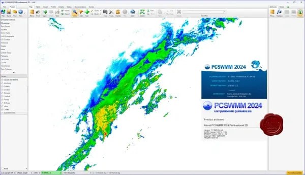
PCSWMM Screenshoot
What‘s New in PCSWMM 7.7.3920
The latest point release focuses heavily on enhancing 2D modeling capabilities, improving the user experience, and expanding the power of Python scripting.
Enhanced 2D Modeling Workflows
-
New Rain-On-Grid Methodology: Rainfall can now be applied directly to the 2D domain and obstructions, enabling more accurate simulation of runoff from buildings and complex urban surfaces.
-
Downspouts Layer: A dedicated layer has been added to specify how rainfall from buildings is routed, improving the connection between structures and the drainage system.
-
2D Profile Panel: Users can now create 2D profiles by drawing transects on the map. This allows for detailed cross-sectional viewing of water surface elevations across floodplains.
Powerful Python Scripting Upgrades
-
Python 3.10.10 Standardization: The scripting environment has been standardized to Python, moving away from the older IronPython dependency for core functionalities and offering a JupyterLab interface.
-
New PCSWMM Python Library (
pcpy): Extensive additions to the API includepcpy.TwoDfor automating mesh creation and raster generation, andpcpy.FloodAnalysisfor specialized flood modeling tasks.
Usability and Performance Improvements
-
System Curve Analyzer: A new tool for EPANET helps analyze pump systems and water distribution networks.
-
LiDAR Support: Direct support for compressed LiDAR (
.laz) file formats streamlines the import of high-resolution topographic data. -
Performance Tuning: Tools like Area Weighting, 2D Create Contours, and Risk Map generation have been significantly accelerated.
System Requirements
To run this software efficiently, your system should meet or exceed the following specifications. Note that hydraulic modeling, especially 2D simulations, is computationally demanding.
Minimum Requirements:
-
Operating System: 64-bit Windows 11, 10, 8, 7, Vista, or XP (SP2)
-
Processor: Multi-core CPU (4 physical cores or more recommended)
-
RAM: 4 GB minimum (16 GB or more highly recommended for large 2D models)
-
Storage: At least 2 GB of available space (SSD recommended for faster data access)
-
Software: Microsoft .NET 4.8 Framework and Microsoft Visual C++ Redistributable (x86)
-
Screen Resolution: Minimum 1366×768 pixels (WXGA); 1600×900 pixels recommended.
Installation Guide
Installing this software is a straightforward process designed to integrate seamlessly with your Windows environment.
-
Obtain the Installer: Download the installation package for PCSWMM 7.7 from the official CHI website portal.
-
Run the Executable: Right-click the downloaded
.exefile and select “Run as Administrator” to ensure all components are registered correctly. -
Follow the Wizard: The installation wizard will guide you through accepting the license agreement and selecting an installation directory.
-
Install Prerequisites: The installer will automatically check for and prompt the installation of required dependencies, such as the Microsoft .NET 4.8 Framework and necessary C++ Redistributables, if they are not already present on your system.
-
Launch and Activate: Once complete, launch PCSWMM from the desktop shortcut. You will be prompted to enter your license key or activate a trial version to begin using the software.
How to Use the Software
Mastering PCSWMM involves moving from spatial data to actionable results. Here is a typical workflow for a professional 2D modeling project.
-
Build Your Model: Start by importing base maps (e.g., OpenStreetMaps) and digital elevation models (DEMs). Use the automated watershed delineation tools to define subcatchments. Draw or import your 1D network of conduits, nodes, and outfalls.
-
Define Properties and LID Controls: Assign land use parameters and soil properties. Utilize the Low Impact Development (LID) toolbox to place green infrastructure. Use the new Downspouts layer to connect building drainage to the system.
-
Generate the 2D Mesh: Define the region for overland flow. The software will generate an unstructured mesh. Use the new Rain-On-Grid methodology to define how rainfall interacts with buildings and terrain.
-
Run Simulations: Select the appropriate EPA SWMM5 engine. Execute single events or continuous simulations to model hydrology, hydraulics, and water quality.
-
Analyze and Automate: View results with dynamic mapping, 3D visualizations, and the new 2D Profile panel. For complex tasks like calibration, use Python scripting to automate parameter adjustments and batch runs.
Alternatives to the Software
Depending on your project needs, budget, and preferred workflow, several alternatives to PCSWMM exist.
-
EPA SWMM: The core engine itself. It is free and open-source, making it an excellent choice for those with programming skills or limited budgets. However, it lacks the native GIS interface and advanced visualization tools of PCSWMM.
-
InfoWorks ICM (by Autodesk): A high-end competitor that also offers integrated 1D/2D modeling, urban catchment management, and river modeling. It is known for its powerful simulation capabilities but comes with a similar or higher price point and a steep learning curve.
-
MIKE+ (by DHI): A comprehensive platform for water distribution, collection systems, and 2D overland flow. It is widely used internationally for complex urban water systems but, like InfoWorks, is a premium commercial product.
-
XPSWMM (by Innovyze): Another industry standard for stormwater and wastewater modeling. It offers similar 1D/2D capabilities and is a direct competitor to PCSWMM in the North American market.
Frequently Asked Questions
What is the difference between EPA SWMM and PCSWMM?
EPA SWMM is the public-domain computational engine developed by the USEPA. PCSWMM is a commercial spatial decision support system that wraps the EPA SWMM engine with a professional-grade GIS interface, advanced visualization tools, and automation capabilities like Python scripting to make modeling more efficient and powerful.
What types of Low Impact Development (LID) can the PCSWMM model?
PCSWMM includes a comprehensive LID toolbox that can model bioretention cells, rain gardens, vegetative swales, green roofs, rain barrels, infiltration trenches, and permeable pavement. These are modeled using a vertical layer system (Surface, Soil Zone, Storage) to simulate physical processes.
Can PCSWMM be used for real-time flood forecasting?
Yes, through the PCSWMM RealTime extension. It can process real-time radar and gage data, apply bias correction methods (like RGMA) to ensure accuracy, and run continuous simulations to predict flooding conditions.
Is there training available for new users?
Absolutely. CHI provides extensive educational resources, including live workshops around the world, over 1,000 pages of self-paced online training, and access to the peer-reviewed Journal of Water Management Modeling.
What are the benefits of the new Python scripting in version 7.7?
Version 7.7 standardizes on Python 3.10.10 and introduces a new pcpy library. This allows for advanced automation of 2D mesh creation, flood analysis, and integration with JupyterLab for data science workflows, making complex analyses more reproducible and efficient۔
Our Paid Service
If you want to Purchase Cracked Version / KeyGen Activator /License Key
Contact Us on our Telegram ID :
Join Us For Update Telegram Group :
Join Us For Update WhatsApp group:
Crack Software Policies & Rules:
Lifetime Activation, Unlimited PCs/Users,
You Can test through AnyDesk before Buying,
And When You Are Satisfied, Then Buy it.